#49 (965) 13.12.2012 – 19.12.2012
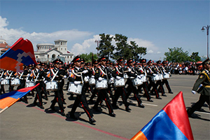
On December 5th during the opening ceremony of newly-erected buildings of one of the divisions of AAD regiment under the command of Colonel S.Grigoryan, Defense Minister Seyran Ohanyan mentioned that AAD troops are exemplary subunits of the national army. The next day final exams of a division (which is recognized as the best in that regiment) under the command of Lt.Colonel V.Hakobyan were conducted, and we were convinced once more that the Minister’s evaluation is fully well-grounded. Examination commission was headed by Deputy Commander Lt.Colonel M.Vardanyan.
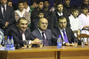
Under this slogan the festival of martial arts started in “Dinamo” sports hall which was organized under the patronage of Defense Minister Seyran Ohanyan. 14 martial arts federations participated in the festival.
The year of 2012 was remarkable for these federations – they signed a memorandum of cooperation which was the initiative of “Dinamo” Sports Union Council’s 1st Deputy Head Garnik Hayrapetyan. According to one of the articles of the Memorandum, the 14 federations are undertaking to inculcate patriotic spirit in the sportsmen of pre-recruit age, prepare them physically and mentally to the service in the Armenian army with honour and responsibility.
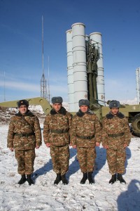
RA armed forces Military-Topographic service was created in September, 1992, its first head was Colonel A.Azizyan. On November 28th the first map was published. In the first years the structure’s aim was to support with topographic maps our troops in war. The first stage of its activity (1992-96) I would describe as formation period. That time we used also the potential of the Institute of Geodesy & Cartography. Owing to brilliant specialists (Captains Youra Varyan, Smbat Davtyan, ensign Lydia Grechukha) and proper organization, the structure was able to fulfill the tasks put by – to support army with topography maps, to investigate localities, renew maps, make locality models.