STORM IN A TEACUP
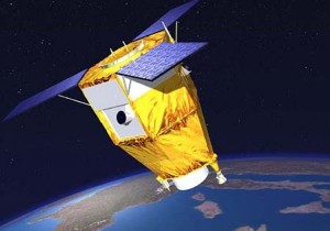
 Recently the French company Airbus Defence and Space commissioned by the company Azerkosmos withdrew a satellite into orbit. As Minister of communication and high technologies of Azerbaijan Ali Abasov informed, satellite SPOT-7 is designed to explore the earth’s surface, it will give the opportunity to get high quality and clear images.
In fact, what opportunities has this satellite? Does it represent a danger for the Armenian side?
Head of RA AF GS Department of topography Colonel G.Manoukyan gives clarifications.
– The French company Airbus Defence and Space is one of the largest aerospace companies in the world, collaborating with many leading companies. With all the innovative approaches, SPOT-7 can not be considered as an intelligence satellite. Intelligence satellites have much greater accuracy and data. Untrue is the information that photographs can be transmitted online.
Of course, the work of the satellite will cause us some concern, however, regardless of their performance, it is classified as a geological and information satellite. Satellite is free in the sense of providing information, has an open status. If desired, the Armenian side can also apply and get pictures of specific areas.
We are concerned about the fact that negotiations are underway for the transfer of control of the satellite to the Azerbaijani side. In this case, data acquisition for us will become complicated.
With a very strong desire photos taken by satellite SPOT-7 can be used for military purposes: to map the terrain, locating large objects, etc. However, we can not say that the leadership of the armed forces of Armenia is concerned: previously powerful satellites have also been launched into orbit, and much more powerful than SPOT-7 and for intelligence purposes.
The Armenian side monitors all processes, takes appropriate steps. In this issue we’ve been working with the Russian side. In the organization “Center of Geodesy and Topography” a receiving station is placed, and if necessary, we can obtain pictures of the satellites of different values.
ARSEN AGHEKYAN
Category: #28 (1046) 24.07.2014 – 30.07.2014, News, Spotlight, Military


